
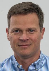
Alexis Berne
EPFL ENAC IIE LTE
GR C1 542 (Bâtiment GR)
Station 2
1015 Lausanne
+41 21 693 80 51
Office:
GR C1 542
EPFL › ENAC › IIE › LTE
Website: https://lte.epfl.ch
+41 21 693 80 51
Office:
GR C1 542
EPFL › VPA › VPA-AVP-DLE › AVP-DLE-EDOC › EDCE-GE
Website: https://go.epfl.ch/phd-edce
Expertise
Precipitation microphysics
Polar precipitation
Geostatistics
Mission
Education
PhD
| Geophysical Mechanics and Environment1999 – 2002 Universit� Joseph Fourier, Grenoble, France
Master (Engineer)
| Water Resources and Development1995 – 1998 Institut National Polytechnique de Grenoble, France
Professionals experiences
Associate Professor
Assistant Professor
Post-doctoral researcher
Post-doctoral researcher
Teaching & PhD
PhD Students
Heather Anne Corden, Clément Alain René Cosson, Gionata Ghiggi, Adrien Francis Olivier Liernur, Morgane Aline Elsa Marine Weiss
Past EPFL PhD Students
Blandine Bianchi (2013), Anne-Claire Marie Billault--Roux (2023), Monika Feldmann (2023), Alfonso Ferrone (2022), Josué Gehring (2021), Jacopo Grazioli (2015), Floortje Elisabeth Maria Van den Heuvel (2019), Joël Jaffrain (2012), Timothy Hugh Raupach (2016), Marc Schleiss (2012), Marc Damien Schwärzel (2022), Daniel Wolfensberger (2018)
Courses
Atmospheric processes: from cloud to global scales
ENV-407
The main objective is to present important atmospheric processes from the local to global scales. The course will start with cloud processes, continue to synoptic phenomena like extratropical cyclones and fronts, to finally cover numerical modeling at the regional and global scales.
Climate change A: causes, impacts, challenges
HUM-121(a)
The course deepens global climate-related issues: the climate system; the impacts of climate change; justice issues and governance ; climate objectives and policies. The interdisciplinary approach introduces group work and scientific methodology.
Remote sensing
ENV-341
This course aims at exposing the students to the main concepts, instruments and techniques of environmental remote sensing. The interactions between waves and matter, different types of sensors and image-processing techniques are presented.
Sensing and spatial modeling for earth observation
ENV-408
Students get acquainted with the process of mapping from images (orthophoto and DEM), as well as with methods for monitoring the Earth surface using remotely sensed data. Methods will span from machine learning to geostatistics and model the spatiotemporal variability of processes.